












Home » Information

Dandenong Ranges Map

A Dandenong Ranges map is most useful when it helps you choose a manageable group of stops. The region includes mountain villages, forest reserves...

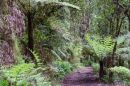
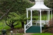
Walking trail through a forested area with benches and a railing on the side.

Dandenong Ranges Information

Planning a visit to the Dandenong Ranges is easier with a few practical details before you set out. The current Dandenong Ranges Point information section is focused on two core visitor-planning topics: maps and weather, making this page best suited to practical trip preparation rather than repeating general attraction information.

Conditions in the hills can be noticeably different from Melbourne, with cooler temperatures, higher rainfall, mist and rapidly changing weather around Mount Dandenong, Olinda, Sassafras and other elevated areas. The region’s winding roads, forest tracks and scattered villages also make a good map useful when planning a day trip or moving between attractions.

Plan Your Dandenong Ranges Visit

  • Weather and seasonal conditions – Check the local forecast rather than relying only on Melbourne conditions, particularly before bushwalking, garden visits or scenic drives.
  • Maps and navigation – Use regional maps to locate villages, major attractions, walking areas and routes through the hills.
  • Walking conditions – Rain can improve waterfalls but also make forest tracks slippery, so suitable footwear and weather protection are worthwhile.
  • Driving in the ranges – Expect narrow, winding and sometimes steep roads, with extra care needed during fog, rain and busy weekends.
  • Seasonal planning – Spring and autumn are popular for gardens, winter brings a cooler mountain atmosphere and stronger waterfall flows, while summer conditions require attention to fire danger.

Browse the information guides below for Dandenong Ranges maps, weather conditions and practical advice to help plan your visit.

Walking trail through a forested area with benches and a railing on the side.

Dandenong Ranges Map

Dandenong Ranges, VIC

A Dandenong Ranges map is most useful when it helps you choose a manageable group of stops. The region includes mountain villages, forest reserves, gardens and foothill attractions spread across several roads; places...

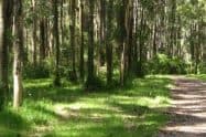
Sunlit forest trail with tall trees and green foliage in the Dandenong Ranges.

Dandenong Ranges Weather

Weather Forecast, VIC

Dandenong Ranges weather can differ noticeably from conditions in central Melbourne. Elevation, forest cover and the shape of the hills influence temperature, rainfall and visibility, so a forecast for the city alone is...

What information should I check before visiting the Dandenong Ranges?
Check the local weather forecast, road and park conditions, and a regional map before travelling, particularly if you plan to go bushwalking or visit several villages in one day.
Is the Dandenong Ranges colder than Melbourne?
Yes. Higher areas such as Mount Dandenong, Olinda and Sassafras are often noticeably cooler than Melbourne and can also experience more rain, mist and cloud.
Do I need a map for the Dandenong Ranges?
A map is useful because attractions and villages are spread across winding mountain roads and forested areas. It can help you plan routes between places such as Belgrave, Olinda, Sassafras, Emerald and Mount Dandenong.
What should I wear when visiting the Dandenong Ranges?
Layers, comfortable walking shoes and rain protection are useful throughout much of the year. In winter, warmer waterproof clothing and footwear with good grip are especially helpful.

Weather Forecast

Upcoming Events