




























Lysterfield Park is one of Melbourne’s most popular outdoor recreation destinations, combining a freshwater lake, swimming beaches, walking trails, picnic areas, wildlife and one of Victoria’s best-known mountain-bike networks.
Located on the southern edge of the Dandenong Ranges, the park offers a very different experience from the forested hills and gardens further north. Instead of steep mountain walks and village attractions, Lysterfield is built around active recreation and open space.
The park’s greatest strength is its flexibility. A family can spend the day swimming and picnicking beside the lake, mountain bikers can explore purpose-built trails, runners can complete the lake circuit, and wildlife watchers can search for kangaroos across the grasslands.
It is one of the rare places near Melbourne where different groups can enjoy completely different activities in the same location.
For visitors planning a Yarra Ranges or Dandenong Ranges itinerary, Lysterfield Park works particularly well as a half-day or full-day outdoor stop.
Why Visit Lysterfield Park?
Lysterfield Park is popular because it offers a combination of activities that are difficult to find together elsewhere.
Visitors come for:
- mountain biking;
- swimming;
- walking;
- trail running;
- kayaking;
- picnics;
- wildlife spotting.
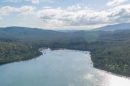
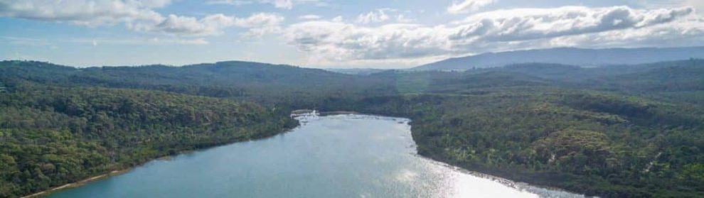
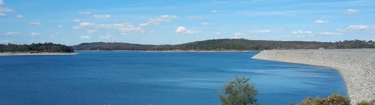
The park’s main recreation area centres around Lysterfield Lake, where open grass areas, beaches and picnic facilities create a relaxed family atmosphere.
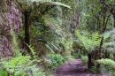
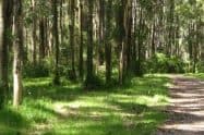
Beyond the lake, the landscape becomes more rugged, with bush tracks and mountain-bike trails extending through the surrounding hills.
This means visitors can choose the type of experience they want rather than following a single attraction route.
Lysterfield Lake Circuit Walk
The Lake Circuit Trail is the easiest way for first-time visitors to experience the park.
The circuit is approximately 5.5 kilometres and takes around 1.5 hours to walk at a comfortable pace.
The route follows the shoreline of Lysterfield Lake, passing through bushland and open areas with views across the water.
It is popular with:
- walkers;
- runners;
- families;
- visitors wanting an introduction to the park.
The track is generally broad and manageable, although visitors should expect natural surfaces and some short hills.
After rain, sections can become muddy, and suitable footwear is recommended.
The lake circuit also provides opportunities to see native wildlife, particularly during quieter periods.
Mountain Biking
Lysterfield Park is one of Victoria’s premier mountain-bike destinations.
The park contains approximately 24 kilometres of purpose-built trails ranging from beginner-friendly routes through to technical sections for experienced riders.
The network includes trails graded by difficulty, allowing riders to choose routes suited to their ability.
The park’s reputation was strengthened when the State Mountain Bike Course hosted events during the 2006 Melbourne Commonwealth Games.
Today, riders visit for:
- flowing cross-country trails;
- technical challenges;
- skills practice;
- longer riding sessions.
Beginners can start with easier tracks and skills areas, while experienced riders can explore more demanding sections with steeper climbs, descents and technical features.
Trail conditions can change after rain, and riders should check current Parks Victoria information before planning a dedicated riding trip.
Swimming & Water Activities
Lysterfield Lake is one of the few major recreational lakes near Melbourne where swimming is permitted.
Two beaches provide water access, particularly during warmer months.
Visitors can also enjoy:
- kayaking;
- canoeing;
- stand-up paddleboarding;
- sailing.
Powered boats are not permitted.
Swimming conditions can vary, and there are no lifeguards. Visitors swim at their own risk and should closely supervise children.
The lake is a natural environment rather than a managed aquatic facility, so visitors should follow onsite safety information.
Picnics & Family Facilities
Lysterfield Park is particularly popular with families because the main recreation areas provide plenty of space to spend several hours outdoors.
Facilities include:
- picnic tables;
- toilets;
- electric barbecues;
- open grass areas;
- beaches;
- walking paths.
The lakeside areas are busiest during:
- warm weekends;
- public holidays;
- school holidays.
Arriving earlier provides a better chance of securing convenient parking and choosing a quieter picnic location.
Visitors should bring food and water, as onsite food options are limited.
Wildlife at Lysterfield Park
The open grasslands around Lysterfield make it one of the better places near Melbourne to see Eastern Grey Kangaroos in a natural environment.
Kangaroos and wallabies are often seen grazing around quieter areas, especially:
- early morning;
- late afternoon;
- weekdays.
The park also supports other native wildlife, including:
- echidnas;
- wombats;
- native birds;
- reptiles.
Visitors should observe wildlife from a distance and never feed animals.
Dogs are not permitted in Lysterfield Park, except for approved assistance dogs.
Accessibility
Accessibility varies depending on where visitors go within the park.
The main lakeside recreation area provides the easiest access, with:
- flatter paths;
- picnic facilities;
- toilets;
- accessible parking areas.
The broader trail network is more challenging, with:
- natural surfaces;
- hills;
- uneven terrain.
Visitors using wheelchairs, mobility aids or prams should focus on the main lake precinct rather than assuming all trails provide the same level of access.
Getting There & Parking
Lysterfield Park is located at:
Horswood Road
Lysterfield VIC
Driving is the easiest way to visit.
From Melbourne, the journey generally takes around 45 minutes depending on traffic.
The main access point is from Horswood Road, which leads to the primary recreation areas and car parks.
Parking is free but can become very busy.
Peak periods include:
- summer weekends;
- school holidays;
- public holidays;
- warm weather.
Visitors planning to swim, picnic or ride should consider arriving early.
Roadside parking is not recommended and may interfere with traffic and emergency access.
Public transport is possible but not particularly convenient. Services reach the broader Lysterfield area, but the park’s size and spread-out facilities make driving much easier.
How Long to Spend at Lysterfield Park
The length of visit depends heavily on the activity.
Short visit:
1 hour
Suitable for:
- quick lake walk;
- wildlife viewing;
- scenic stop.
Half-day visit:
2–4 hours
Suitable for:
- swimming;
- picnic;
- walking;
- family activities.
Full-day visit:
4+ hours
Suitable for:
- mountain biking;
- multiple activities;
- relaxed outdoor day.
Lysterfield is one of the Dandenong Ranges region’s best attractions for visitors who want flexibility rather than a fixed itinerary.
Nearby Attractions
Lysterfield Park combines well with:
- Cardinia Reservoir;
- Emerald;
- Ferntree Gully;
- Dandenong Ranges National Park;
- Belgrave and Puffing Billy.
Its location also makes it a convenient stop for visitors exploring the southern and western foothills of the ranges.
Lysterfield Park FAQs
Can you swim at Lysterfield Park?
Yes. Swimming is permitted at designated beaches at Lysterfield Lake, but there are no lifeguards, and visitors swim at their own risk.
Are dogs allowed at Lysterfield Park?
No. Dogs are not permitted in Lysterfield Park except for approved assistance dogs.
How long should I spend at Lysterfield Park?
Allow 2–4 hours for a typical visit. Mountain bikers, swimmers and families combining multiple activities can easily spend a full day.
Is Lysterfield Park suitable for families?
Yes. The lake area provides swimming, picnic facilities, open space and walking options suitable for family visits.
Can beginners mountain bike at Lysterfield Park?
Yes. The park has trails suitable for different experience levels, although riders should choose routes that match their ability.
When is the best time to visit Lysterfield Park?
Summer is popular for swimming, while cooler months are often more comfortable for walking and riding. Early mornings are generally quieter year-round.



Are dogs allowed?
Hi Lyn,
According to the Parks Victoria website, dogs are now allowed at Lysterfield Lake (Assistance dogs are welcome).
This is likely due to the abundance of wildlife here.
You can view more information on this at https://www.parks.vic.gov.au/places-to-see/sites/lysterfield-lake.
Thanks,
Michael
Is cafe open?
Hi Kerrie,
I am not sure if the cafe is open, I believe it closed in 2016, but not sure if it has reopened. If you would like to take a picnic, there are two picnic areas along the lake shore and both have toilets, picnic tables and free electric barbecues which visitors are free to use.
Best regards,
Jess
Is that timing just for entry or Exit aswell?
Hi Sam,
Lysterfield Park will open between 8am – 7pm during the autumn/winter months.
Best regards,
Jess
Is there fishing allowed in listerfield if so what species
Hi Rob,
Park regulations do not permit recreational fishing, but fishing tuition by authorised groups is permitted from jetties on the western shoreline. Lysterfield Lake was stocked in the 1980s, predominantly with Brown Trout, and further stocked with Brown Trout and Rainbow Trout in 1995.
Best regards,
Jess
Has the cafe at lysterfield reopened?
Hi Nola,
The latest information on the cafe from Lysterfield Park is as follows:
Parks Victoria – 30 November 2016
“The Trailmix Café at Lysterfield Park is currently closed. It is anticipated that expressions of interest for a new lease of the site will be sought. Parks Victoria will assess the options for the future management of the former Trailmix cafe to ensure the best outcome for the park, the community and the local tourism industry. Normally an expression of interest process takes 6-12 months, however this is dependent on the successful proponent and the proposals put forward.”
Kind regards,
Jess
The cafe at Lysterfield Park – when is it open?
Hi Sherry,
The latest information on the cafe from Lysterfield Park Cafe is as follows:
Parks Victoria – 30 November 2016
“The Trailmix Café at Lysterfield Park is currently closed. It is anticipated that expressions of interest for a new lease of the site will be sought. Parks Victoria will assess the options for the future management of the former Trailmix cafe to ensure the best outcome for the park, the community and the local tourism industry. Normally an expression of interest process takes 6-12 months, however this is dependent on the successful proponent and the proposals put forward.”
Kind regards,
Jess